Wednesday, April 30, 2008

Herodion 2: Who was Herod?

We don't really know what Herod looked like, but we know he descended from Idumeans, the descendants of the biblical Edomites, traditional enemies of the Jews. But over the 1200 or so years between Joshua's conquest of the land of Israel and Roman rule, the Edomites had gradually moved into southern Judea, which the land of Israel was called at the time, and slowly assimilated the beliefs and practices of their Jewish neighbors. After the Jewish revolt in 3597 (136 BCE) overthrew the Seleucid Empire and replaced them with the Jewish Hasmonean dynasty, the newly sovereign Jews weren't sure how to handle this minority. Finally, the Hasmonean kings simply converted them on mass. There are opinions that the conversion was forced, which, by halachah, would have made it invalid. Still, the Idumeans seem to have been absorbed into the Jewish people seamlessly and a few years later, when Judea was conquered by Rome, they did not return to their idolatrous roots but remained faithful to Judaism.


Then the Roman-appointed Idumean ethnarch (administrator) of occupied Judea passed away, his position passed to his son. Judea, being a border province, was subject, like all border provinces, to the occasional barbarian invasion. During one such assault, the Jews took advantage of apparent Roman weakness to try to revolt against the empire and reestablish a Jewish kingdom. Herod, following the advice of his late father, stuck with the romans, and so the Jews came after him. Fleeing on horseback, he, his family, and a contingent of loyal guards, made it about eight miles southeast of Jerusalem when his mother's carriage overturned.

Surrounded by the Jewish rebels, he decided, like a good Roman, that it was time to take his own life rather than be disgraced in capture. As he prepared to die, his mother told him she was not badly injured, to take heart, that he would yet survive. Regaining his will, he managed to fight his way out of the trap and escape to freedom.

Eventually, he made it all the way back to Rome and met with Emperor Octavian. To make a long story short, he managed to receive Octavian's blessing and an appointment as a proconsul-in-exile, and was dispatched with two Roman legions to recapture Judea for the Romans. He made short work of the Jewish revolt, and, in typical Roman style, began a period of mass executions, both of his military enemies, rabble-rousers, and his own political rivals within his family.

Territories ruled by Herod


Later in his life, with his rule firmly established, he began the construction of a massive palace on the exact spot where he had almost lost his life.


Today, the ruins of this palace, called the Herodion, stick out like a sore thumb from the surrounding Judean hills. For one thing, the mountain ruins of his fortress has an odd flattened top. The hill alongside it has also been shaved down a bit so there should be no competition. Herod spared no slave labor in the creation of his flashy palaces.


The Herodion as it must have looked.
While the Herodion was just as lavish as Herod's other building projects in the holy land, including his renovations of the Second Temple and construction of the Western Wall at which Jews pray to this very day, this project had one major difference. All of its opulence was hidden on the inside. Surrounding the palace was a sheer stone wall which sent a clear message to passers by. "What goes on behind these walls is none of your business."
A view taken from above, peering down into the Herodion itself, illustrates.
Photo not taken by me (our bus didn't fly.)
More tomorrow...

Tuesday, April 29, 2008

Herodion 1: Givat HaArba

Well, the week of Pesach is over, and I'm back to blogging! It was a wild and crazy Pesach, and I was darting all over the country on tours. One of my favorites was a tour to the Herodion, one of the most significant archaeological finds dating to the period of Roman rule.
To get our bearings, we first went to Givat HaArbah, "The Hill of the Four," which was once a Jordanian position a few meters across the "Green Line," the 1949 armistice line between Israel and the Jordanian occupied territories. The hill got its name from four Israelis who strayed too close to the border and were killed by Jordanian sentries. Today, it provides a commanding view of the surrounding area.

TO the north is Kibbutz Ramat Rachel. This Kibbutz was founded in 1926. As was true for the entire country, the facts on the ground set the borders of the state. Because the Kibbutz was able to survive the Jordanian invasion of 1948 through to the end of the war, the "Green Line" was drawn to include it. The border ran right through the valley in between them (shown below.)


Olive groves in the border of Kibbutz Ramat Rachel
The fight to capture Givat HaArbah in 1967 was tough and bloody. Soldiers who tried to capture it by direct assult were gunned down in the fields. Eventually, the Air Force was called in and bombed out the bunkers.

Bombed out Jordanian bunkers.

Closer Up

To the west is the "contraversial" building project of Har Homa. This hill, which was across the border, housed the remains of a Byzantine era defensive fortress. The only clearly visible remain from a distance was the "Wall," or "Homa," in Hebrew. Israeli soldiers guarding the border looking across aptly named it "Har Homa," "Wall Mountain," and the name stuck. Recently, construction of a massive new Jewish neighborhood has been continuing apace, and Prime Minister Olmert incurred the wrath of his American handlers when he approved a few hundred additional housing units there last month.

Har Homa

Har Homa up close

To the south, is Beit Lechem, "The House of Bread," also known as Bethlehem. The birth village of David Hamelech, King David, it is today firmly under the anarchic realm of the Palestinian Authority.


Olive groves and terraces, on what is probably some of the most expensive real estate in the country, and Bethlehem.

The spires of churches in the old city of Bethlehem peeking up ober contemporary buildings. Today the city has been largely Islamified, and it seems likely that it will have been completely de-Christianized in the coming decades.


A large concrete wall shelters civilization from the Palestinian Authority.

And off in the distance is the Herodion. It's clearly artificial top, and the lowered top beside it, make it an obvious landmark.

Next stop... the Herodion.

Wednesday, April 23, 2008

In and Around Jerusalem

With Chol Hamoed Pesach (the indermediary days of the Passover Festival) upon us, millions are off of work, yeshivot and schools are empty, and I find myself wandering around the city. So I snapped some random shots.

The bridge is coming along now. You can see it from almost anywhere in the city.

A shul in Har Nof (Chareidi Neighborhood)
Flags are coming out, Independence day is coming up.
The public burning of the chametz (leaven products forbidden during Pesach.)
Ad for tours during Pesach.

And today I went hiking through the forests east of Jerusalem.

A natural spring East of Ein Kerem

A wandering scorpion

Looking towards Mevasseret Tzion

We came across a lool (chicken coop.) Life behind bars, no parole.

A view of Ein Kerem hospital and Har Nof in the background.

Monday, April 21, 2008

Journey to the Jordan 4: The Northern Shores of the Dead Sea

Our next stop was the northern shore of the Dead Sea (I seem to be coming here a lot lately.)

A British vacation house built on what was once the shore of the Dead Sea during the British Mandate (1917-1948.)

After Jews were free to return to the Arava region in 1967, after a 19 year absence, the Labor movement, which still controlled the entire state system, began the debate over what to do with the newly captured territory. Having reached the decision to settle, the first new settlements were built on the ruins of those which existed prior to 1948. Beit HaArava was one of the first, founded by the kibbutz movement. It was only one year before 1968, which was remembered worldwide as the year liberalism transformed into a more anti-establishment ideology. This is, not coincidentally, also the year Palestinian Nationalism was invented. The Israeli left gradually drifted into the same anti-establishment sentiments seen worldwide, which was particularly ironic since they were, themselves, the state. While the first labor-party Kibbutz, Beit HaArava, was founded by the Labor movement, and survives to this day, the secular-socialist settlement movement never really took off. The movement had already peaked and was in decline. Instead, it would be the religious settlers who would provide the bulk of the numbers for this new wave of building.

Meanwhile, the state made some deals with Arab investors across the river in the Hashemite Kingdom of Jordan to try to develop the region. Such deals, of course, had to be kept secret, since Israel and Jordan were still at war, and Jordan still claimed this region as its own.

The hotels, built along the northern Dead Sea, never really took off, and today their ruins still litter the roadside.

An abandoned, 1970's-era hotel.

The hotel had an ampitheater, open to the dead sea, where concerts could be held.

The Ampitheater

The shores of the Dead Sea used to come right up to the steps. Today the sea has retreated probably about a kilometer away as it slowly dries up.

Steps into the phantom water.

One tenant (grasshopper) never checked out.

The hotel is in need of some minor structural repairs.

On the walls is a cool-looking mural of the Holy Land, based on a Midieval manuscript.

The Galilee

The Hula
The artist got creative and painted flames shooting out of Sdom (Sodom.)


It's not pretty, but the structure still stands. Given the building ban and housing crunch in the Jericho region, perhaps some day some enterprising youth will come to put the structures back to use as a yeshivah or a school. I know just the types to do it.

Thursday, April 17, 2008

Journey to the Jordan 3: The Ruins of Beit HaArava

After the Six Day War, the soldiers began making makeshift memorials to those who died in defense of the kibbutz back in 1948. Eventually, the bodies were found in a collective grave, and a small memorial was built to the fallen.


In the distance, a group of John Hagee Christian tourists at the graves of the fallen.


Some of our tour group at the sign pointing to the grave.


The grave stone.

The soldiers were a bit unhappy about being distracted from their normal soldiering routine to cater to a bunch of tourists and cleared us out after a few minutes.


"Eeeh okay. Please to get on the bus now!"


Actually, there's one more point of interest in the above photo. That small tuft of trees directly over the head of the soldier who is to the left is Beit Hoglah, a small outpost where Machon Meir guys volunteer and where I spent a shabbat once.


Our next stop was about five kilometers to the north. For Christians, this is the spot where their religion's Jewish founder took a dunk in the Jordan river, so it's surrounded with Christian monuments. Across the river is the Hashemite Kingdom of Jordan, which has poured money into renovating these memorial spots, to give tourism a boost.


This spot had special meaning for the John Haigee group (at the water's edge.)


In fact, this is approximately the location of the crossing of the Jordan river from Har Nevo (Mount Nebo) on the east side to Gilgal in the west. In fact, unlike at the Sea of Reeds (Red Sea,) in this case, the entirem nation crossed over all at once. Unlike other Tanachic references to Beit HaArava and Yericho as specific locations, the Jewish encampment under Yehoshua at Gilgal is a reference to a large area, which it would have to be to hold the entire nation of Israel, at that time numbering approximately 2.5 million including women and children.


The Jordan river, placid and wide. Relatively wide.


Yours truly in front of the Jordan.


Unlike the crossing of the Yam Suf (Red Sea) the miraculous crossing of the Jordan River did not involve a split, but the water in the Jordan reversed course and exposed dry land for a significant section of the river's length. The Kohanim (priests) entered the river first, at which point the river turned back, and all of Israel passed over. Each tribe took with them one stone from the bottom of the Jordan river, making a pile of twelve stones as a monument to their crossing at the encampment of Gilgal.

Wednesday, April 16, 2008

Journey to the Jordan 2: The Original Beit HaArava

The plains of the Jordan Valley are referred to as the "Aravah," rooted in the word, "Maarav," west, as they are the immediate western side of the Jordan River. From Mitzpeh Yericho, in the distance, one can see the reconstituted agricultural kibbutz of Bet Haarava.

The green fields of Bet HaArava.

The soil here is fertile but loaded with salt from the evaporating Dead Sea, and must be washed clean before anything can be grown. The weather is also violently, mercilessly hot during the summer, and it is an incredibly inhospitable environment. Beit HaArava was originally established by Jewish refugees who had been members of Zionist youth movements, who fled Nazi Germany in 1939.

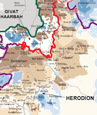
Immigrant families landing in Beit HaArava.

Scouting out the western shores of the Dead Sea.


Kibbutz life

Established adjacent to the Jordan River, along the northern tip of the Dead Sea, Beit HaArava was a productive settlement, and was also involved in the first attempts at extracting minerals from the Dead Sea through evaporation.

Building evaporation ponds.


Completed evaporation ponds.


Mining the Salt


Of course, in 1948, Beit HaArava was to be first in line to be struck in the invasion of the Jordanian legion. The leader of Beit HaArava, however, managed to make a deal with King Abdullah of Jordan that the settlement would not be touched. He then drove to Tel Aviv to tell Ben Gurion, Israel's first Prime Minister, that Beit HaArava would not need to be evacuated. Unfortunately, he arrived on May 14th, 1948, the day of the signing of Israel's independence declaration. Ben Gurion was a bit busy that day. So he headed back and was kileld in a car accident. Ben Gurion, not knowing of the deal, ordered the settlement's evacuation. Only five soldiers stayed behind to fight the invading Arabs, and were killed in its defense. The Jordanians, under the command of the British General Glubb Pasha, had the decency to bury their victims.

Beit HaAavah is significant to Tanach because it appears in the book of Yehoshua as defining the border of the tribal region of Binyamin (Benjamin):

In chapter 18:

"And [the border of the tribe of Benjamin] passed along toward the slope opposite Aravah northward, and went down unto the Aravah; And the boundary passed along to the slope of Beit Choglah northward; and the end of the boundary was at the north bay of the Yam HaMelach (the Salt Sea, the Dead Sea) at the south end of the Yarden; this was the southern boundary... This was the inheritance of the children of Binyamin, to its boundaries all around, according to their families. Now the towns of the tribe of the Bnei Binyamin according to their mishpekhot were Yericho, and Beit Choglah, and the valley of Ketzitz, And Beit HaArava"

Tuesday, April 15, 2008

Journey to the Jordan 1: Mitzpeh Yericho

With Yeshivah on Bein Hazmanim, "Between Times," i.e. Pesach (Passover) vacation, I was able to get on another Tanach Tiyul with Ezra Rosenfeld's group (email him here if you are visiting Israel and are interested in going on one of his tiyulim.) This time we made it out to the Jericho region to relive the crossing of the Jordan river, which happened precisely 3,280 years ago on this very day.


First, we went to Mitzpeh Yericho (Jericho View) to get a good look at the situation.


Looking down at a Wadi (dry riverbed) from one of Mitzpeh Yericho's hilltops.


Mitzpeh Yericho is a religious settlement linking Jerusalem with the Jordan Valley, built along the ancient Jerusalem-Jericho highway. Looking to the East, Jericho, now under the rule of the Palestinian Authority, sprawls behind the hills.


Yericho (Jericho)


Looking to the west, the towers of Jerusalem poke through the horizon.


The "Twin Towers" on Har Hatzofim, a.k.a. Mount Scopus, in the neighborhood of Givat Tzarfatit (French Hill) in Jerusalem.


Mitzspeh Yericho itself has about 300-400 families (I've heard different numbers given at different times.) The settlement continues to expand from hilltop to hilltop, government building ban or no.


A new "Givah," hilltop, of Mitzpeh Yericho in the bottom left.


Looking to the North.


Looking Northeast one can see Kfar Adumim and Allon.


Downhill is Vered Yericho (Jericho Rose.) It is situated right on the edge of Jericho itself, though relations with the locals are relatively good. Relatively being a relative term.


Vered Yericho and Yericho itself.
The clump of green is Vered Yericho. The building to the extreme left is the Yericho casino, a vestige of the corruption induced by the Oslo peace process.


More photos tomorrow. Stay tuned!