I'm posting all of my previous posts of
Yaffo here in one giant post.
Our journey to Yaffo began at night. Driving from the Jerusalem hills, descending to the coastal plain, the warm ocean air is a nice change of pace from chilly Jerusalem.
Yaffo, known as Jaffa in English, is one of the handful of settlements in the Land of Israel which was inhabited for centuries prior to the Zionist revival of the land. at which it was a largely Turkish and Arab city.
 An old postcard from Turkish Yaffo
In biblical times the region of Jaffa, being on the coastline which was always on the fringes of Jewish control. The Philistines, a Greek seafaring people, settled the rim of the Mediterranean sea, and with their mastery of blacksmithing were able to keep the Jews most concentrated in the mountain regions of what is today Judea and Samaria (aka the West Bank.)

A map displaying Philistia in relation to the areas of Jewish settlement in the times of King David.
As can be seen in the map above, the yellow coastal strip controlled by the Philistines including Gaza, Ashkelon, and Ashdod stretched north to the area Jaffa area. When the Land of Israel was divided amongst the twelve tribes upon entering the Land of Israel, this region was assigned to the tribe of Dan. To this day, the cities of Tel Aviv-Yaffo and its surrounding suburbs are known as "Gush Dan."

As a matter of fact, as is detailed in the book of
Shoftim (Judges,) Dan never actually made it here because of the Philistine presence. Instead, they wandered far, far to the north to find open land. Their inability and lack of determination to conquer their portion of the Land of Israel, as did several other tribes, is considered one of the major lapse by many religious commentators.
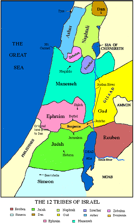
The area allotted to Dan in the map above is labelled "Original Land Given to Dan." We can see where they actually ended up, in the far, far north of the land, in what is today Lebanon/Syria.
Jutting out from the Coast, the topography formed a natural harbor, and
Yaffo became the port of entry to the Land of Israel for the first pioneers.

The night view of Tel
Aviv, standing in
Yaffo.

Yaffo, aka "Jaffa," on a map of greater Tel Aviv, lower left.
Like most of the older cities of
Eretz Yisrael,
Yaffo was designed before the advent of city planning and building codes. With walls built of solid stone, doorways had to be arched to support the weight.
 An alleyway in the old city of Yaffo, slow exposure.
Yours truly in that same alleyway.The old city is on a Tel (mound,) with layers of previous civilizations buried beneath. The tel slopes steeply down toward the sea.
 Looking back at Tel Aviv from Yaffo.
Even in the previous century, in the days when Yaffo was the chief port of entry to the land of Israel, "port of entry" was a relative term. The harbor was never dredged, so the truly large ships had to remain out at sea. Pilgrims and immigrants coming to the Holy Land disembarked from their large passenger cruisers onto smallboats rowed by laborers, which took people the rest of the way ashore.

Night fishing behind the jetty.Today, the harbor is used as a small marina. The larger port cities of Haifa, Ashdod, and Eilat have been dredged to accommodate the larger vessels of today. Meanwhile, the Yaffo harbor has been left behind and is in a state of disrepair. There is talk of refurbishing the harbor and turning it into a major tourist attraction, like the Old City of Jerusalem, but so far they remain just plans, not action.
Yaffo also happens to be the site of a major battle. Well, actually, it was the site of many battles over the millenia, most of them long forgotten. But by far the most famous of those remembered was Napoleon's march through the holy land. On March 4th, 1799, having swung through Egypt and now making his way north, Napoleon's forces besieged Yaffo. Within two days, he had already breached the walls, and his men stormed the city, looting its goods and slaughtering over 2,000 of its defenders.

Yours truly with Napoleon. Talk about a "Little Man's Complex."
Napoleon was eventually able to get a handle on his troops, but the damage was done. With 2,000 rotting corpses came disease. Soon, a plague broke out amongst Napoleons troops. Napoleon then, as the story goes, ordered his doctor to administer poison to his infected troops to prevent the disease from spreading. The doctor refused, and word spread quickly that Napoleon had tried to have them killed. These rumors sparked the first tremors of a mutiny among the ranks. To quell such rumors, Napoleon visited his sick soldiers in the hospital, going to great lengths to touch and come close to them, proving he was unafraid of the disease. He then commissioned a famous painting of himself visiting the sick. Entitled, "Napoleon at Jaffa," it what was probably the closest thing to a photo op they had at the time.

"Boneparte Visiting the Plague Victims of Jaffa"
 Our tour group gathering in the plaza with the little Napoleon guy.
 Walking through the alleyways, past the shops and art galleries of today.
Yaffo has actually been settled since ancient times. Beneath the tel (archaeological mound) on which the contemporary city is built is layer upon layer of ancient civilization.
A current dig is exposing an Egyptian fortress from the late bronze age, around the year 2500, or 1300 BCE on the secular calendar. This date would put it at almost the same time as the Jewish exodus from Egypt. Wonder how long it took them to get word of the 10 plagues.


More excavated Egyptian ruins.


Coming to the top of the tell, we see a fantastic view of Tel Aviv. Roughly 20% of Israelis live here.
 Foreground, the flora and older buildings of Yaffo. Background, Tel Aviv.
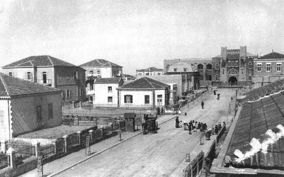
By the late 1870s the walled city of Yaffo became too cramped and could no longer accomodate the growing population, and the first suburb beyond, Neve Tzedek, "Abode of Justice," sprouted up beyond the city walls.
 Rachel, our Nefesh B'Nefesh event organizer, shepherds her lost tourist-sheep into Neve Tzedek.
 Our tour guide takes us to the original well.
Neve Tzedek is also the site of some of the first orange groves planted by Jews in Israel, as the ideology behind the Zionist revolution was beginning to take shape. It would be another nine years before Theodore Hertzl would publish Der Judenstadt, which would initiate the era of the organized return of Jews to Eretz Israel.
 The first well and orange groves outside the Yaffo city walls. The orange trees are painted white to prevent evaporation.

With he light welling up from the inside, it looks sort of like a direct elevator to hell.

Looking at one of the first houses built in Neve Tzetek.
Finally out of the city walls, Neve Tzedek was built with the more modern construction for the time period, including running water and toilets. These amenities induced many of the great early names of Zionist thought to settle in the area, including the Nobel Prize laurete author Shmuel Yosef (Shay) Agnon, artist Hachum Gutman.

Shay
AgnonNeve Tzedek also became the home of the great Rabbi Avraham Yitzchak Kook, whose mystical and nationalist writings, as expanded upon by his son Tzvi Yehudah Kook, formed the theological basis of the National Religious movement.

Rabbi
Avraham Yistchak Kook.

Rabbi
Tzvi Yehudah Kook
As the building in Neve Tzedek continued, a group of pioneering individuals purchased a few acres of empty dunes north of Yaffo. Of course, there were disagreements between the settlers over who got which piece of land, so they cast lots to select parcels (reminiscent of Joshua's division of the land in Sefer Yehoshua, the Book of Joshua.)
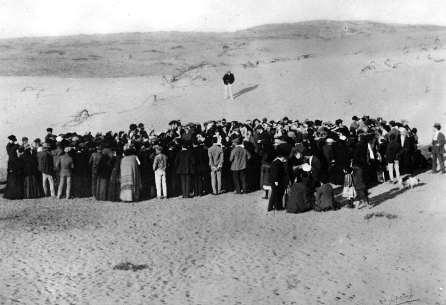 Casting lots.
Their new town would be called "Tel Aviv," the Hill of Spring. It's a reference to the book of Yehezkel (Ezikiel) 3:15, "Then I came to them of the captivity at Tel Aviv, that lived by the river Chebar, and to where they lived; and I sat there overwhelmed among them seven days."
Early Tel Aviv.The name was taken by Theodore Hertzl in his book, Altneuland, "Old-New Land," to describe his vision of the first Jewish city in the resurrected Land of Israel. The term "Tel" is an archaeological mound, the word "Aviv" means "Spring," so the name was symbolic of the rebirth of Jewish sovereignty on the ruins of the ancient destroyed Jewish state.
The main street of the new city became, appropriately, Hertzl Street.
 On Hertzl Street. One of our tourists holds up an old photo of the street. Today the street is not what it used to be.
 This espresso bar is actually one of the first structures built in Tel Aviv. At the time, it was an ice cream parlor. Anyone who's ever experienced Tel Aviv's miserable summer humidity, and then imagines the days before air conditioning, can understand why this was a priority.
In one of the ironies of history, many of the early Zionists fleeing persecution in the German-speaking countries were architects and artists, who brought with them the Bauhaus architecture of their birth lands, with its simple, open design, focused on functionality. Later, when the Nazis came to power, they opposed the style as being to decadent and reminiscent of the failed Weimar Republic. After Germany was bombed to rubble after world War II, Tel Aviv became one of the only places where original Bauhaus architecture still existed, and in 2003 Tel Aviv was declared a United Nations World Heritage Site.
 Some of the Bauhuas architecture. It was a bit tough to do it justice at night.
The house of Tel Aviv's first mayor, Meyer Dizengoff (which I thought was amusing, you know, Meyer is the Mayor, ha ha,) anyway, his house was used for Israel's declaration of Independence.
 It didn't typify the Bauhaus architecture for which Tel Aviv was famous. In fact, is was quite an ugly building. So why was it used?
 As is so often the case in Jewish history, great achievment against impossible odds was spurred by the lack of any other option. In an attempt to strangle Jewish freedom in the grave, the Arabs had already besieged Jerusalem and the Egyptians were marching north. Israel had no choice but to declare independence and fight the odds.
Meir Dizengoff's house was selected for the Declaration of Independence not for any historic reasons, but because it had small windows and a large basement, where they could be protected. The Egyptian air force was already in the air, ready to begin the areal bombardment of Tel Aviv.
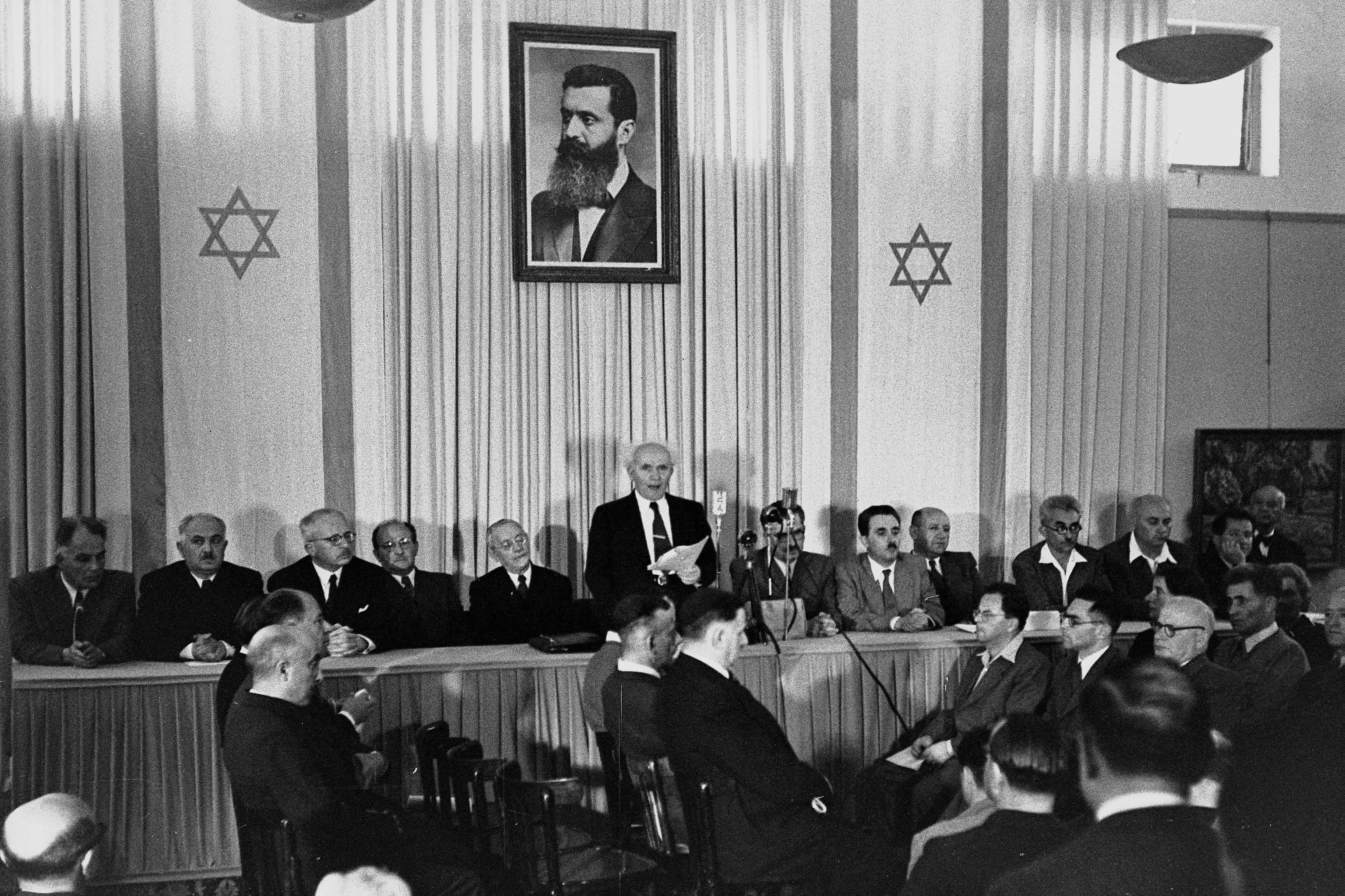
David Ben Gurion declares independence in Tel Aviv on May 14, 1948. 11 minutes later, the United States was the first country to recognize the reborn State of Israel, and Egypt was the first nation to attack.

 (Click for a larger version)


